The Power of Place: How Audubon Park Disrupted Manhattan’s Grid
Two Illustrated Talks
Tuesday, April 14 at 7:30 p.m. Rapid Transit Forces a Rapid Transformation
Tuesday, April 21 at 7:30 p.m. Riverside Drive Runs Through It
The Grinnell, 800 Riverside Drive (Gallery Space) at 158th Street (NYC)
Open to the Public Free of Charge
Guided Walk
Sunday, April 26, 2015 at 12:30 p.m. and 2:00 p.m. (2:00 p.m. now full)
Beginning at the Audubon Monument, 155th Street East of Broadway (NYC)
Open to the Public Free of Charge.
Space is limited. To reserve a spot, please email MatthewSpady@AudubonParkNY.com

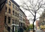
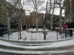
The distinctive footprint that disrupts Manhattan’s grid west of Broadway between 155th and 158th Streets—the Audubon Park Historic District—did not come about by accident or from the demands of local topography. It unfolded from careful planning and alliances among like-minded property owners, whose social and political connections ensured that when progress swept up Manhattan’s west side, they would benefit. As a result, Riverside Drive splits at 155th Street where its 1911 branch snakes across the grid to 158th Street while its 1928 branch pushes straight up the river. At the same time, Edward M. Morgan Place—a one-block remnant of the earlier Boulevard Lafayette—slices across Audubon Park’s eastern side, severing a corner from what was once a geographically unified suburban enclave.

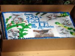
For the story of how this unusual footprint evolved, join me for a series of two illustrated talks (Tuesdays, April 14 and 21 at 7:30 p.m.) and a guided walk through the Audubon Park Historic District (Sunday, April 26 at 2:00 p.m.). The talks will take place in the gallery space at 800 Riverside Drive and the walk will begin at the Audubon monument, 155th Street, east of Broadway. All three events are open to the public free of charge. No reservations are needed for the talks, but space is limited for the guided walk, so please reserve a spot by emailing me at MatthewSpady@AudubonParkNY.com. At the conclusion of the walk on Sunday, April 26, participants are invited to join the Riverside Oval Association’s annual John James Audubon birthday party.

With a collection of vintage photographs, prints, and maps, we’ll begin the series with a look at the two families who shaped Audubon Park’s history and the historic district’s unusual footprint: the Audubons, who transformed their farm Minnie’s Land into a railroad suburb, and the Grinnells, whose pragmatism re-imagined that suburb as a twentieth century cityscape. With these two families as point of reference, the first talk will focus on the subway’s effect on urbanization north of 155th Street and the second on how Riverside Drive defines the cityscape between 155th and 158th Streets. Bringing these themes together, the Sunday afternoon walk will be an on-site exploration of how past and present meet in the Audubon Park Historic District’s footprint.


